| Title |
Parrot - Thermal Drone 4K - Anafi Thermal - 2 High Precision Cameras - Thermal Camera -14°F to 752°F + 4K HDR Camera - The Ultra-Compact Thermal Drone for All Professionals | Potensic T18 GPS Drone, FPV RC Quadcotper with Camera 1080P Live Video, Dual GPS Return Home, Follow Me, Adjustable Wide-Angle Camera, Altitude Hold, Long Control Range -Black |
| Top Features |
- Thermal Pro drone: anafi thermal is the ultra-compact and lightweight thermal drone imaging solution, efficient and accessible to all. Always ready for take-off, it revolutionizes the way you work and gets the most out of your missions, even the most complex ones, thanks to the reliability and precision of its controls and the power of its engines. With 2 cameras: thermal (-14°F to 752°f) and visible (4K HDR) with 180° tilt, 3x zoom and 3 batteries.
- 2 high precision cameras: Capture the invisible and visible. The flir radiometric thermal camera measures and displays everything you can't see by revealing thermal differences in the areas and elements you fly over: hot spots, cold spots, thermal leaks. The 4K HDR camera with 21MP Sony sensor dedicated to visual inspection accurately inspects a frame and captures details to illustrate the condition of a structure or a search area.
- Compact and high performance: for the first aid, Civil security and inspection professions, speed is of the highest importance. Thanks to its unique foldable, ultra-compact and lightweight design (Less than one pound! ), the anafi thermal UAV always remains within reach, unfolds and is operational in 3 seconds. 26 min flight time smart battery (3 batteries) - Wi-Fi connection up to 2. 5 mi - Automatic return to takeoff point - customizable geo-barrier - wind resistance 31 mph.
- Thermal imagery accessible to all: from the freeflight 6 application, you can switch very simply from an RGB view to a thermal view or merge the two for a more Easily understandable Rendering. The details of the scene are visible and colored to reveal thermal differences and heat loss areas. In a few seconds you can share photos and videos of your missions. Play back the videos and change the settings palette to isolate an item or analyze temperatures.
- Maximum working altitude - 4,500m above sea level. Compatible mobile devices - Screen size up to 10 inch
- Adapted to the needs of all professionals: for the construction industry, anafi thermal draws up thermal surveys and an overview of thermal losses. For Civil security, It can monitor heat points without endangering the personnel. In the energy sector, it can identify a high voltage cable power failure or isolate a defective Solar panel. Quiet, anafi thermal will also be able to approach animals without frightening them
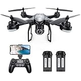
| - [1080P HD Wi-Fi Camera] Equipped with 1080P HD camera and 75° adjustable angle, the drone can capture high-quality video and aerial photos, and can also provide high-speed picture transmission without delay(1080P camera needs 16/32G SD card).
- [Longer Flying Time & Control Distance] Up to 10 min flying time and 300m control distance, giving you a more pleasant flight experience.
- [Dual GPS] GPS positioning + GLONASS positioning provide you with accurate positioning details of your drone. It can also provide automatic return, low power return and no signal return.
- [Follow Me Mode] Follow to the GPS in your smartphone to make sure your drone automatically follows and captures you wherever you go.
- [All-Round Functions] Headless mode, altitude hold and one key takeoff / landing for easier operation, no need to worry about orientation. With a simple press on the button your drone will rise to a height or land, perfect for beginners. Note:GPS drone needs to calibrate GPS signal before taking off.
|